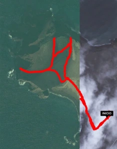
It is our last day in The Azores and we have decided that we will spend it hiking up Ponta dos Capelinhos, the volcanic formation at the eastern end of the island of Faial. We arrive at the lighthouse and set off on the Subida ao Vulcao dos Capelinhos route. The trail takes around two hours (longer if, like me, you stop every few metres to take photographs) and has a distance of approximately 3.2 kilometres, beginning and ending at the Interpretation Centre.
We make our way across the black sand towards the dirt path that leads to the top. As we look up we can just make out a few people walking across the top of the mound. From here they look like ants.

We set off, following the sandy trail. The land we are now walking over was created by the eruption of the Vulcao dos Capelinhos in 1957/1958. Prior to the eruption the sea would have covered this area and the land would have ended where the lighthouse stands. The landscape changes and as we lose sight of other hikers it begins to feel as though we are walking through the set of an apocalypse movie with the barren, lunar landscape.

At the top is a small cairn, which we add a stone to. The term ‘cairn’ comes from the Gaelic work ‘carn’, meaning a ‘mound of stones built as a memorial or landmark’. The tradition has existed within Scotland for many years and has four main purposes. The first is to mark a grave or in memory of a loved one passing. The second is a symbol of success when climbers reach the summit of a mountain. Thirdly, cairns can be used as a form of a path and lastly it can be used as a landmark to help mariners determine their location.
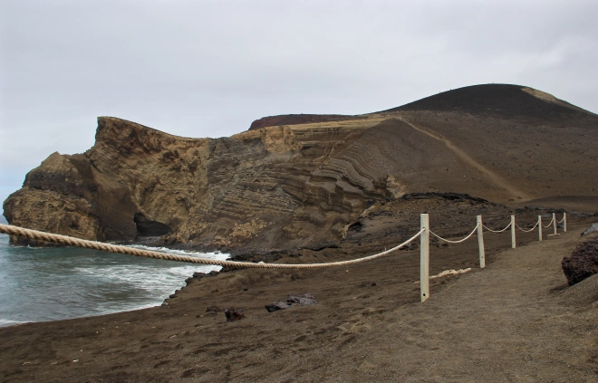
The view from the summit is simply spectacular! We find ourselves looking down on a little cove with a black-sand beach and a small sea cave. The rock looks like it has been cut in half and we can see the beautiful shades of red and the various layers of rock that would usually be hidden under the surface.

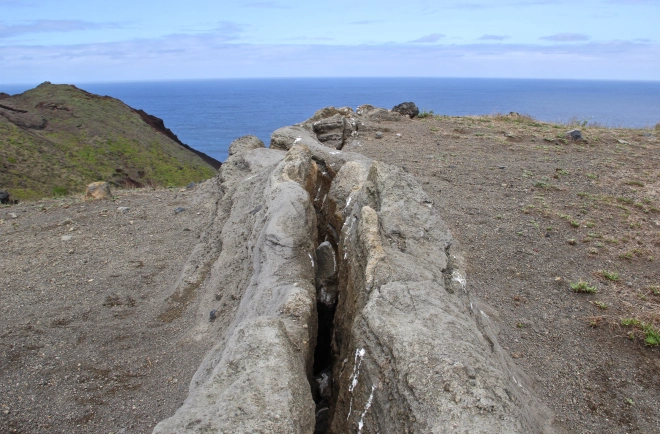
We pass a huge crack in the ground and see the steam rising from it. The fumes that escape from volcanos consist mostly of water (steam) and can be emitted from the hot interior even when the volcano is dormant. The steaming usually increases dramatically as magma intrudes and heats the groundwater beneath a volcano. Magma gives off carbon dioxide and hydrogen sulphide that do not totally dissolve in groundwater and can therefore show up at the surface. It is the hydrogen sulphide that gives the steam the ‘rotten egg’ smell that was so pungent at Furnas in Sao Miguel. Here the smell is not very strong as there is only a little steam being emitted.

Another trail leads us back down the mound and we trek across the barren ground. We are not sure where this path leads us but soon we find ourselves at the edge of a drop, overlooking another magnificent view. We can see the waves thrashing against the rocks, revealing wave-cut sea caves and benches as they retreat.

As we follow the path back around the hill towards the lighthouse the landscape transforms again. The scenery has changed from black, volcanic rocks to red, iron-rich sand to beige, volcanic sandstone. We watch the seagulls swooping down into the sea to catch fish and then flying back up onto the sandy cliff, their safe haven away from predators. People have carved their names and the dates they have visited into the smooth volcanic sandstone, commemorating their hike over piece of land that relatively few people will have placed foot on. It really is incredible to think that just 58 years ago none of this existed!
HIKE DETAILS
- Distance: 3.86 kilometres
- Time: 1.5 hours
- Difficulty: Medium

SOURCES:
- http://www.azores-islands.info/uk/places/faial/ponta-capelinhos.html
- http://turismo.cmhorta.pt/index.php/en/what-to-do/walking-trails/volcano-hike
- http://www.scotland.com/blog/cairns-of-scotland
- http://volcanoes.usgs.gov/about/faq/faqprecursor.php


